Maps of Allatoona Pass
Map Legend
The Battle
Opening Moves
10:00 AM
10:20 AM
10:30 AM
10:40 AM
10:50 AM
11:00 AM
12:00 PM
1:30 PM
2:00 PM
Then and Now
Order of Battle
Wargaming Allatoona Pass
Bibliography |
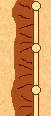
Here is a quick legend defining the different military symbols and terrain features shown on the maps.
|
Ten companies make up a regiment, and can consist of anywhere from 1-100 soldiers. Many of the companies by late 1864, especially on the Confederate side, consisted of less than a dozen soldiers. In addition, they can often be detached for service elsewhere, which is why many of the Union regiments are not at full ten company strength. The “company” icon is also used here to depict an informal group of soldiers grouped together for an impromptu mission. |
|
The regiment was the basic maneuver element of both armies during the Civil War. At Allatoona Pass some Confederate regiments numbered fewer than 100 soldiers, less than regulation company strength. The Union regiments on the map are shown by company since there were numerous detachments made during the battle, and we have a fairly accurate knowledge of where each company was. Confederate regiments are shown as whole units. In both armies, two or more regiments were grouped together into a brigade. Two or more brigades were formed into divisions. |
|
Artillery was a major component of both Civil War armies. With one exception, the Union artillery stayed within the two redoubts during the battle, and the Confederate artillery was more than a thousand yards away providing long range support. |
|
Fieldworks consisted of a wall of logs that had a ditch dug on the inner side. The soldiers then piled the dirt from this ditch on the outside of the works, the side facing the enemy. Another thick log was propped up on top. The soldier could then fire through the gap between the top of the wall and this headlog. This provided a great measure of protection from enemy small arms fire, and artillery fire if thick enough and deep enough. |
|
A rifle pit is what we would call a foxhole today. It was a simple 1-3 man hole, made much the same way as fieldworks with a smaller wall and piling the dirt from the hole on the outside. Many even had headlogs. The icon shown can depict one or more rifle pits grouped together. |
|
Forts, or redoubts, were well-designed structures made to provide permanent protection for important terrain such as town, supply depots, or strategic terrain features. They were also used in elaborate defensive lines as anchors and artillery locations at important tactical points. They had thick earth walls several feet high, with embrasures for artillery pieces to fire through. They were also surrounded by deep ditches, making them almost impossible to climb into without scaling ladders. |
|
A footbridge was constructed over the railroad cut to help movement and communication between the two forts. It was made from two pine tree trunks lain across the cut, with boards nailed down as flooring and handrails added. A supply of artillery ammunition was located near the western end on the shelf. |
|
Buildings |
|
Railroad Tracks |
|
Roads |
|
Trails |
|
Forest |
|
A black arrow indicates planned or purposeful movement under orders such as an attack, or an ordered retreat. |
|
A red arrow indicates unplanned movement, such as a disordered retreat or rout. |
Time
Let's talk a little bit about the maps and the times listed on them. First, keeping track of time was very subjective during the Civil War. Few soldiers, or even officers, had watches. Those officers that did have watches were generally higher level field officers; colonels and generals. The watches were unreliable, not because of any poor construction, but because there was no standard time synchronization. An officer might set his watch to a local town clock, or another officer, which in turn could be different from an officer in another unit. Add to this the fact that the watch could run down and need rewinding before it slows down the hands and you can see the problems in everyone keeping track of the same time. Now add to this the enemy and his attempts to keep track of time and report it, and you can see the problems with making a timeline for a battle and the units moving around on the field. Even one as small as Allatoona Pass!
The times listed on the maps are approximates, based on the reports and writings of the two combatants in the opposing armies. What is important is the chronology- the sequence in which events happened. One regiment moving on the 10:40 AM map may have actually started moving at 10:33 AM and finished moving at 10:48 AM. The important thing to consider is that when it moved, it moved after the events shown on the 11:30 AM map but before those on the 10:50 map. |
|