
|
|
Then and Now
The Pickett’s Mill Historic Site is one of the best preserved Civil War battlefields in the country. The only additions that have been made to the park are trails, many of which follow the wartime roads, trail markers, the visitors center, and bridges across the creek. There aren’t even any unit markers or monuments in the park to obstruct the view. Time has, of course, changed a few things. The three main fields are smaller than they were during the war. Unfortunately, the park rangers cannot clear the surrounding forest and restore the original boundaries of the fields because a few species of endangered plants have begun to grow there. Also, farmers leveled some of the earthworks before the formation of the park, and none of the original buildings on the land remain intact. The map below shows the battlefield as it looked during the battle. Several of the pictures have additional winter views taken from the same camera location. The absence of foliage in the winter photos can help the view get a better understanding of the topography and terrain features. 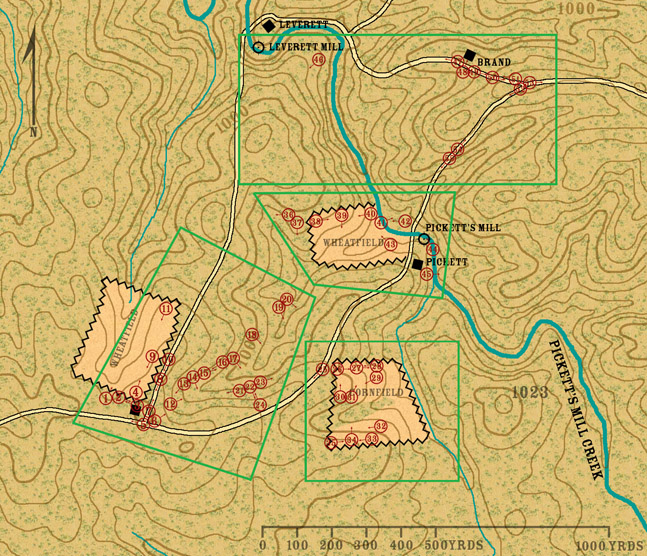 |
|
All images, text, and video © Historic Imagination Optimized for viewing at 1024 x 768 or better |
||